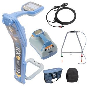




COMPATIBLE ACCESSORIES

COMPATIBLE SOFTWARE

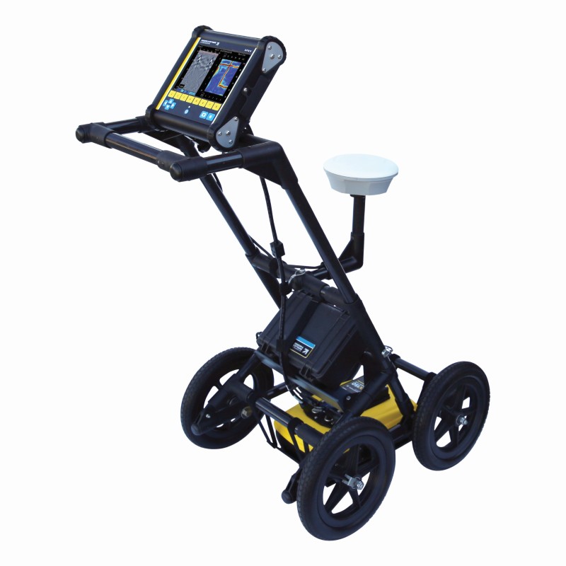
LMX150 FINDAR Ground Penetrating Radar (GPR) System

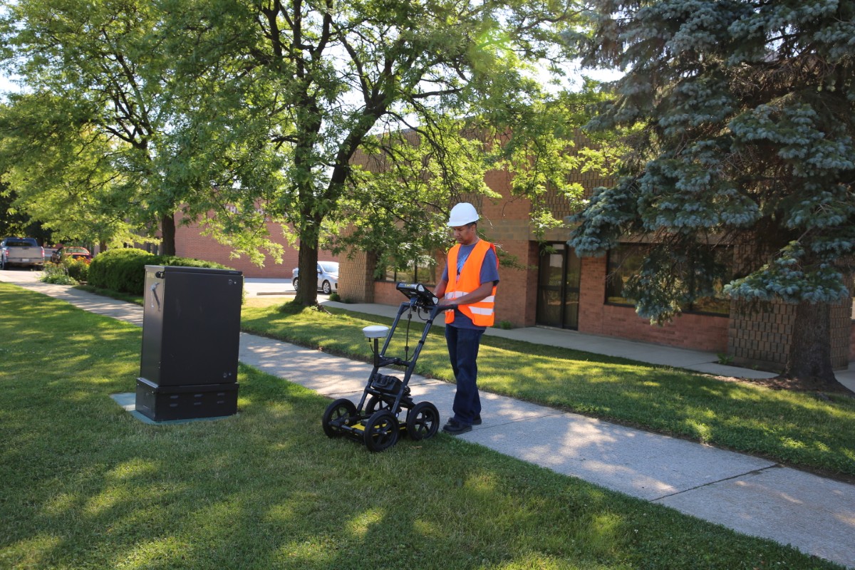
LMX150™ GPR complements traditional pipe and cable locators and allows you to locate targets below the surface.

The LMX150SG system is an all-in-one, plug-and-play solution to add high-accuracy positioning to your LMX150 GPR data. The SG bundle unlocks powerful locating and mapping advantages while in the field and post-processing. 

Data from the LMX150 system can be exported to the EKKO_Project GPR Software for further analysis and reporting. 

GNSS is an essential component for LMX150 / LMX200 workflows where accurate mapping, positioning, and survey data capture are required.

SKU: 10/LMX150-FINDAR-GPR

Price range: $28,952.00 through $41,311.00 ex. GST

Add to Quote
Circular loading icon. A gray radial array of rounded rectangles indicates a process is in progress. Loading symbol for websites and apps.

Rapidly locate metallic and non-metallic utilities

Enhance your productivity

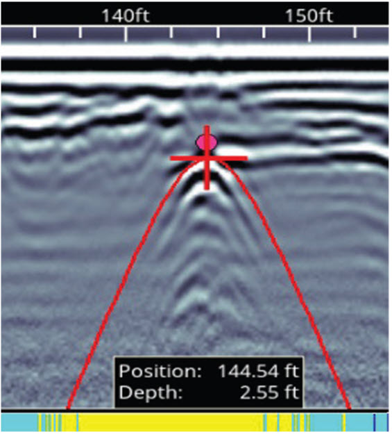
Pinpoint Depth & Location

LMX150 pinpoint depth and location screen

No complex settings. Just press Start and push the cart.

Easy Depth Calibration

LMX150 easy depth calibration screen

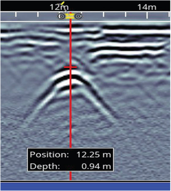
Use hyperbola-fitting to ensure accurate depth measurements and back up over the target to display its location and depth.

Increase your target confidence in the field with image optimisation

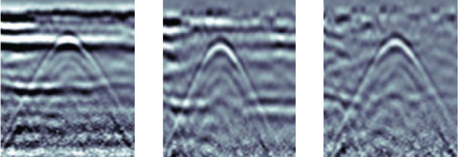
Preset Filters

LMX150 preset filters comparison

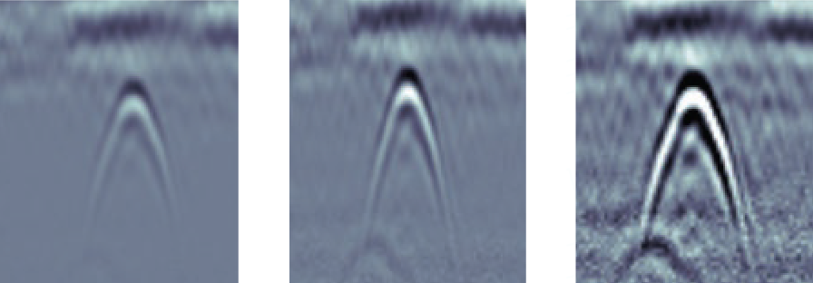
Adjustable Gain

LMX150 adjustable gain comparison

Optimize visibility of your targets with preset filters and gain adjustments.

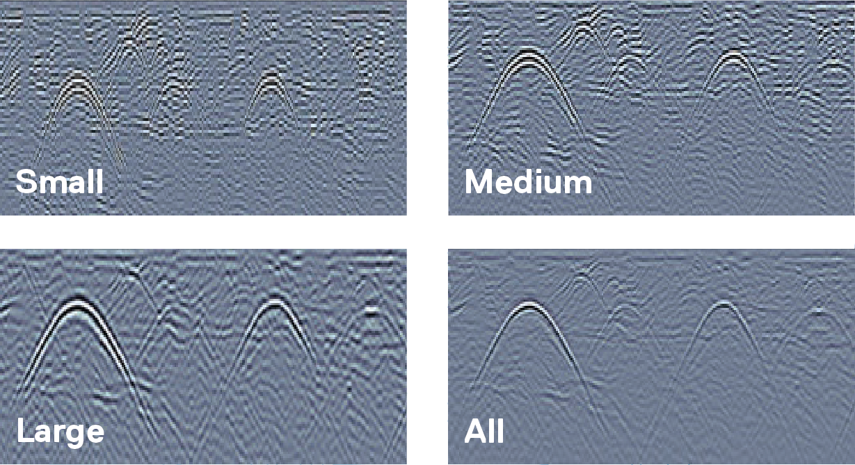
Dynamic Target Enhancement (DynaT)

LMX150 Dynamic Target Enhancement DynaT comparison

Enhance small, medium and large targets depending on your field conditions.

Grids & Depth Slices

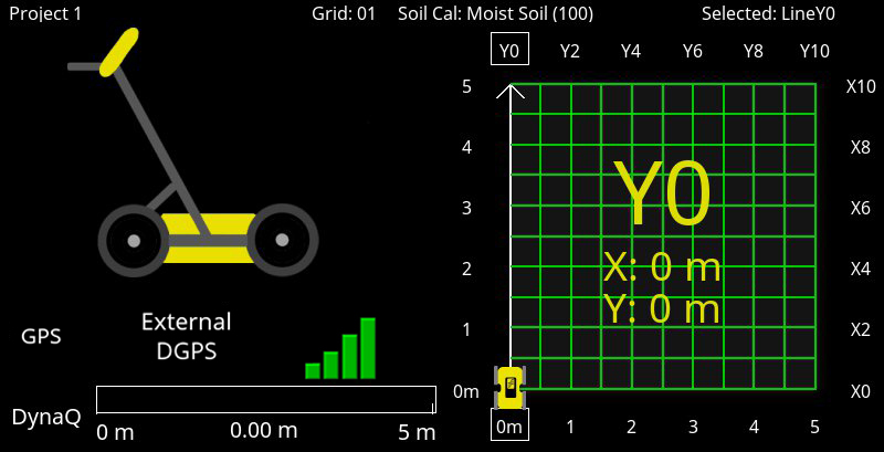
LMX150 guided grid collection screen

Flexible & guided grid collection

The LMX150 guides you through setup with pre-selected grid sizes. Stop lines early, or skip lines.

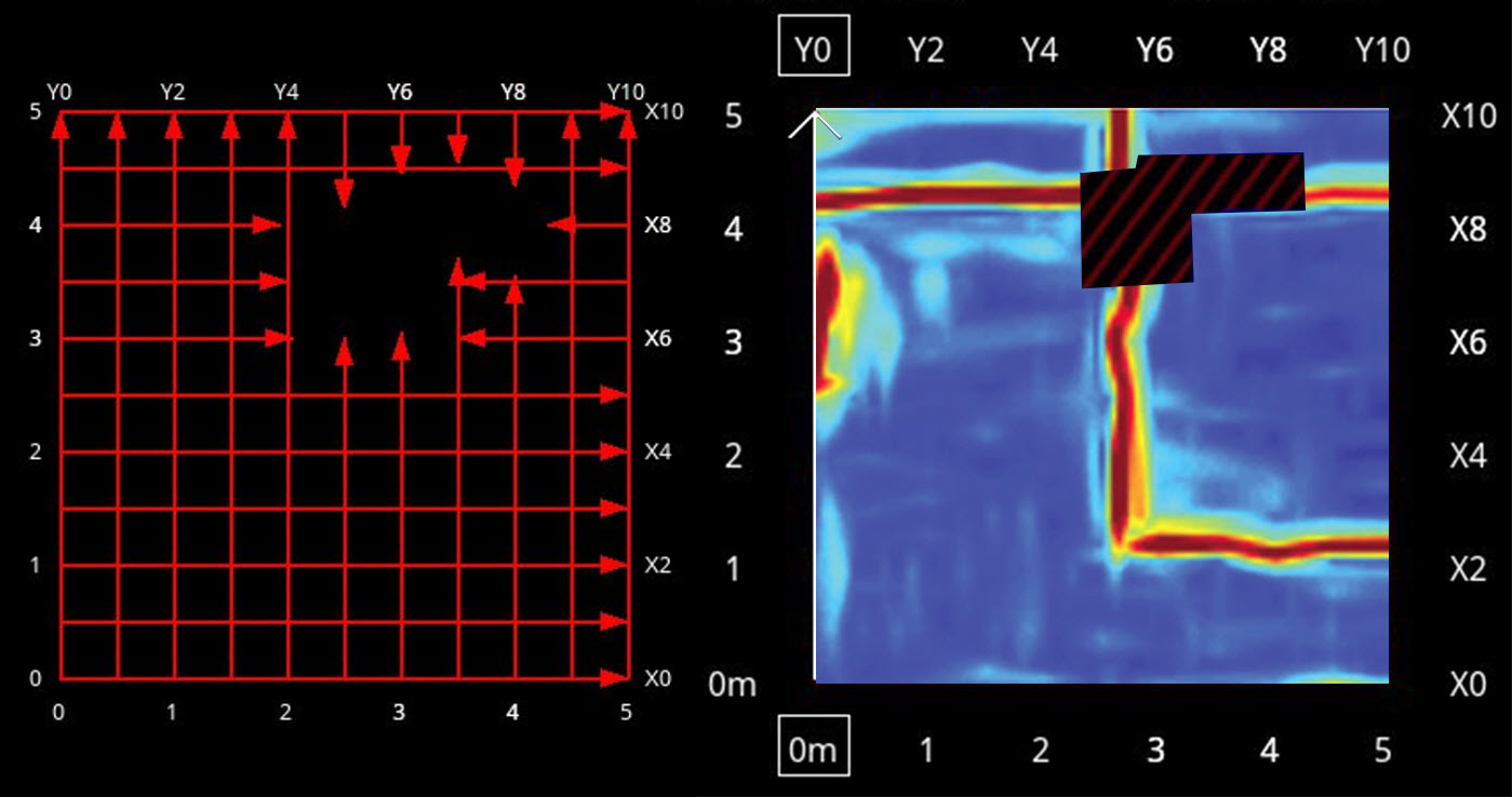
LMX150 obstacle avoidance grid screen

Obstacle avoidance

System guides data collection around an obstacle in your grid.

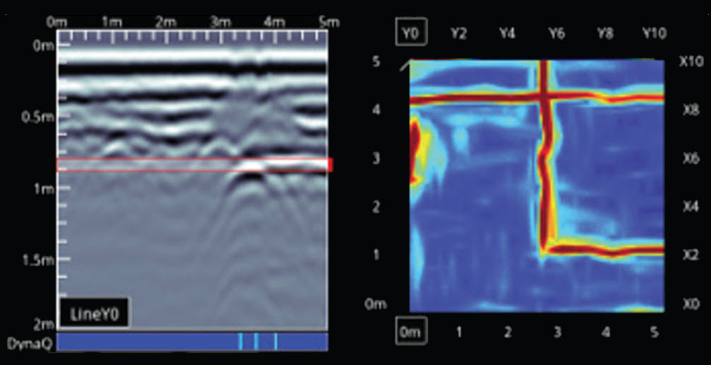
LMX150 in-field depth slices screen

In-field Depth Slices

Process grid data into depth slices and move down through your data to visualize targets at different depths on-site.

FEATURES UNLOCKED WITH EXTERNAL GNSS

Enhanced in-field locating

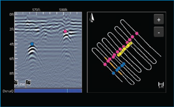
Instantly see interpretations in MapView as you add them to hyperbolas in the cross-section, helping to identify utility targets.

SplitView

GNSS SplitView screen

Instantly see interpretations in MapView as you add them to hyperbolas in the cross-section, helping to identify utility targets.

MapView

GNSS MapView screen

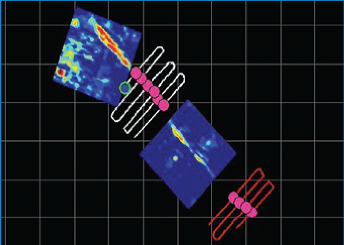
Visualize your entire GPR survey including depth slices, interpretation and flags to gain better understanding of complex locates.

Accurately map your findings

Export mapped findings in common file formats for GIS, reporting and third-party mapping applications.

CSV output

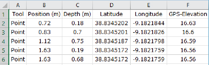
CSV spreadsheet export example

CSV file icon

Spreadsheet .CSV file with georeferenced flags and interpretations can be used to create maps in third-party mapping applications.

KMZ output

KMZ file icon

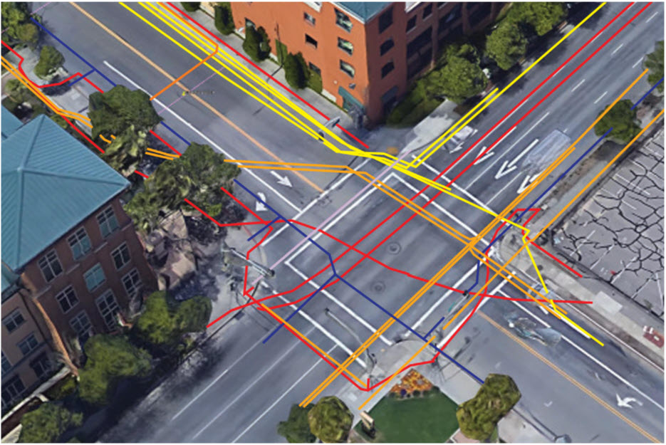
Automatic KMZ output of line, grid interpretations and screenshots, allowing utility maps to be easily created.

POWER

Battery Capacity 9.0 Ah
Battery Weight 3,6kg
Battery Life 4-6 hours
Charger 110-240V

ENVIRONMENTAL & TEMPERATURES

Ingress protection rating IP65
Operating temperature range -20°C to +50°C

PERFORMANCE


Data storage 230km of data
Depth Up to 3 metres

PHYSICAL CHARACTERISTICS

Weight 19kg (including battery)
Display unit size 21cm diagonal
Unit dimensions 1150mm × 550mm × 900mm

  • Metal utilities, including pipes and cables
  • Non-metallic pipes, including PVC and asbestos cement
  • Concrete storm and sewer systems
  • Utilities where installed tracer wiring has failed
  • Underground storage tanks and drainage tiles
  • Septic system components
  • Fiber optic cables
  • Non-utility structures such as vaults, foundation walls and concrete pads

Accurate Positioning is Critical for GPR Surveys

Use your GPR to accurately position buried assets, determine the location of detected subsurface objects, identify areas to avoid digging and record the locations of all assets. Sensors & Software’s SG for GPR accessory bundles provide an out-of-the box solution to integrate high-accuracy GNSS positioning into your GPR data. Every SG package includes a pre-configured Geode™ GNSS Receiver by Juniper Systems® with connectivity, setup, and battery management all taken care of at the system level, making it easy to incorporate precise positioning into your GPR workflow.

SG Package includes Optional RTK upgrade adds
Features
  • Single-frequency (L1)
  • Multi-constellation including GPS, GLONASS, BeiDou, GALILEO
  • Multi-frequency (L1, L2, L5)
  • Galileo High Accuracy Service (GALHAS) support
Accuracy 30cm RMS 1cm RMS with RTK correction service
20cm (with GALHAS)
Correction services Local SBAS correction (free)

  • WAAS in North America
  • EGNOS in Europe
  • GAGAN for South Asia
  • MSAS for East Asia
  • Ground-based NTRIP cellular correction services, available free of charge in some areas, or through paid subscriptions
  • The satellite-based correction service, ATLAS, provided by Juniper® Systems
  • For a list of Geode-compatible RTK correction services available in your region, visit junipersys.com
Configuration Pre-configured ready to use out of the box NTRIP or satellite corrections must be configured in Geode Options provided
Custom cable Noise-suppressing power cable:

  • Removes interference with GPR signals
  • Powers the GNSS directly from the GPR battery
Data integration GNSS positioning data is integrated directly into GPR data for powerful locating and mapping advantages in the field and post-processing.
System Compatibility LMX®, NOGGIN®, pulseEKKO®, SPIDAR®